
From the airport
The airport is situated in the Northeastern part of Brussels. Three main options are at your disposal (http://www.brusselsairport.be) :
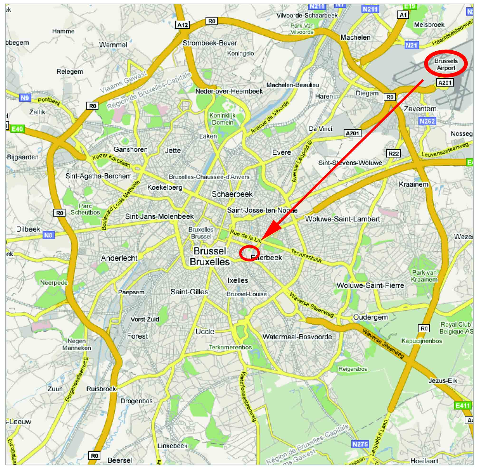 Map of Brussels. The red circle in the upper left of the map indicates the Brussels Airport. The red circle in the middle of the map indicates the RBINS. |
Train. Bus. Taxi. |
From the rail stations
 |
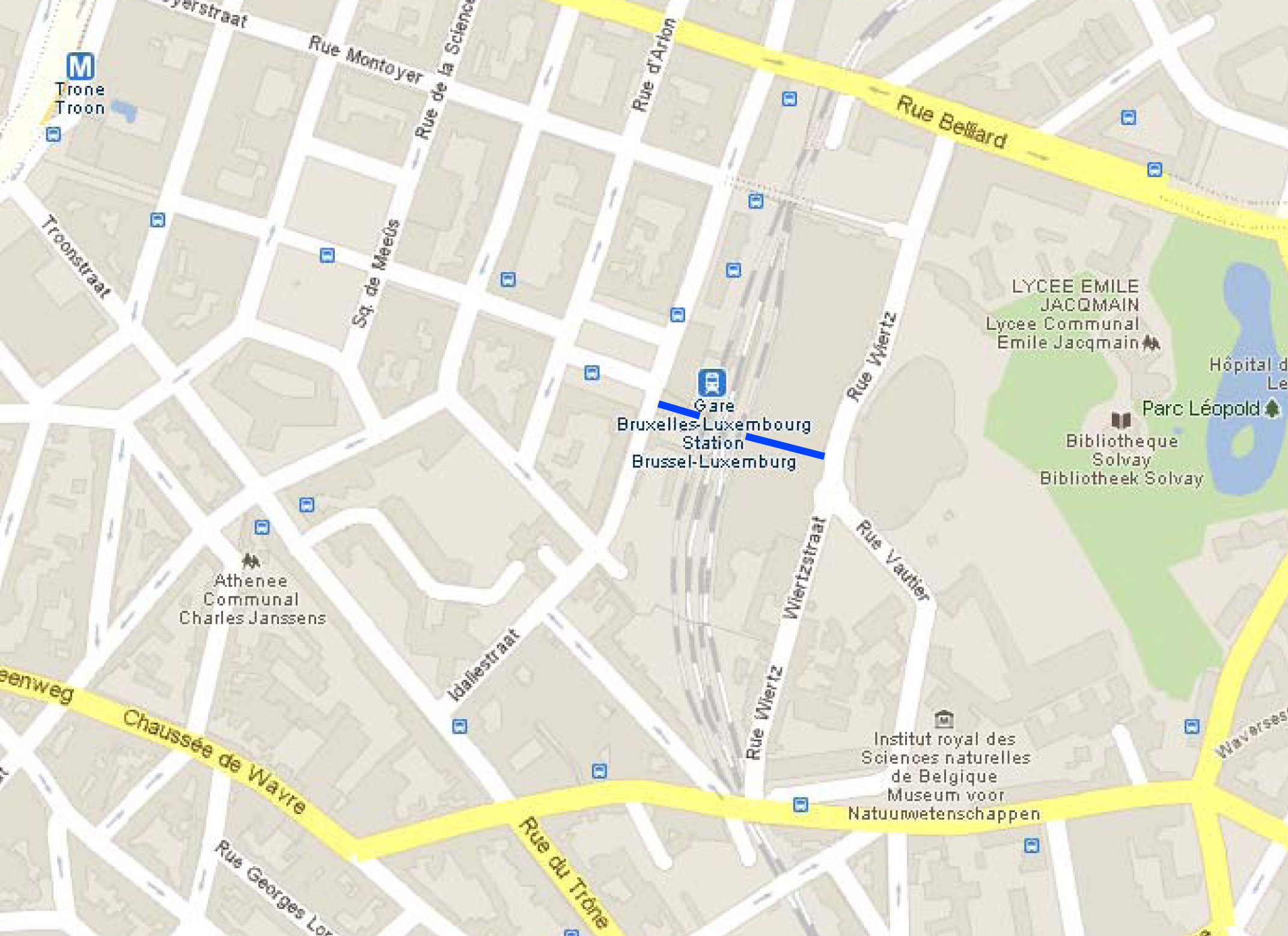
Several rail stations are present is Brussels. Brussels Luxembourg, Brussels Schuman, Brussels Central and Brussels Midi are the main stations to reach the RBINS. The easiest one is Brussels Luxembourg which is only 5-7 min by foot from the RBINS. You can walk through the European Parliament to the RBINS (see blue path on the map below). From Brussels Schuman (1.2 Km from the RBINS), you can walk through the Jourdan Place. From Brussels Central or Brussels Midi stations, you can take another train to the Brussel Luxembourg station.
|
|
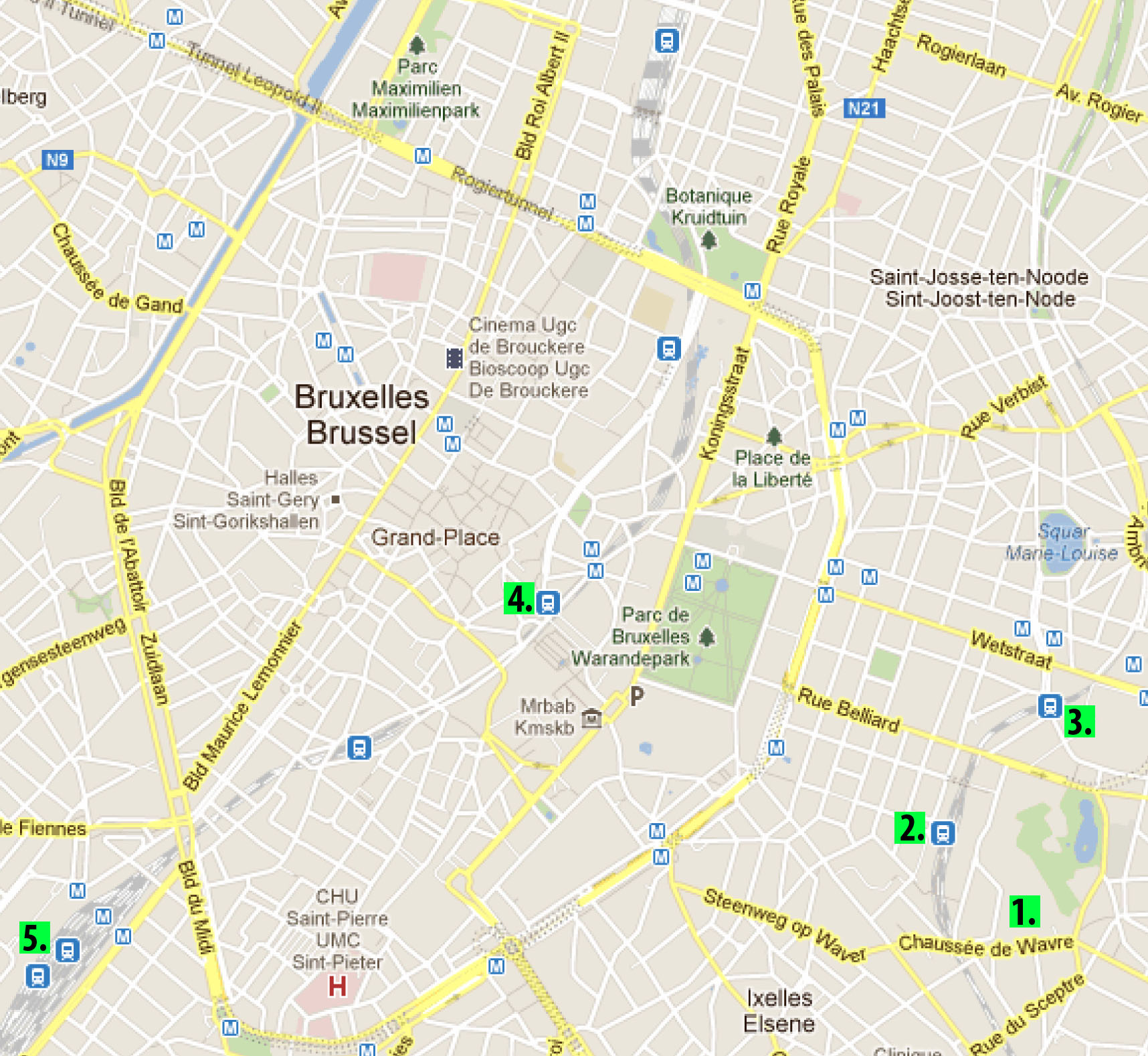
Close-up map of Brussels. 1. RBINS. 2. Luxembourg station. 3. Shuman station, 4. Central station. 5. Midi station. |
 |
 |
|
View of the area around the RBINS. The Trône station is on the left side of the map and the Luxembourg station is near the center of the map. The blue line indicates the path through the European Parliament reaching to the Vautier street. |
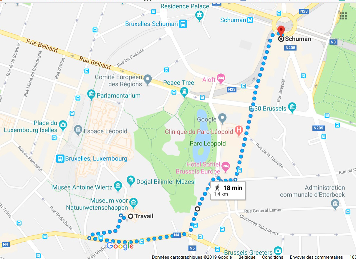
Map indicating the way to reach the RBINS from the Schuman rail station. |
To the RBINS parkings
The RBINS is situated in the center of Brussels, near the European Parliament (see red circle on the here below map). Directions to the RBINS can be found on our website: http://www.naturalsciences.be
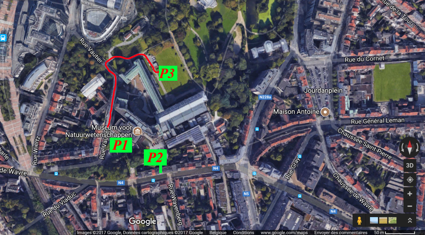
Three parkings are available. The first one (P1) is in front of the main entrance of the Museum (Rue Vautier 29, 1000 Brussels). The second one (P2) is bigger as comprising two levels. The access to this parking is possible only via the Wavre roadway. Finally, few parking places (P3) are also available in the park in the back of the RBINS. The access is provided via a path running from the lower part of the Vautier street (see the red line on the map below). Between 7.00 and 9.30 am, Parking 1 and 2 are only accessible with an electronic badge. After 9.30 am, the access is possible without the badge.
 |
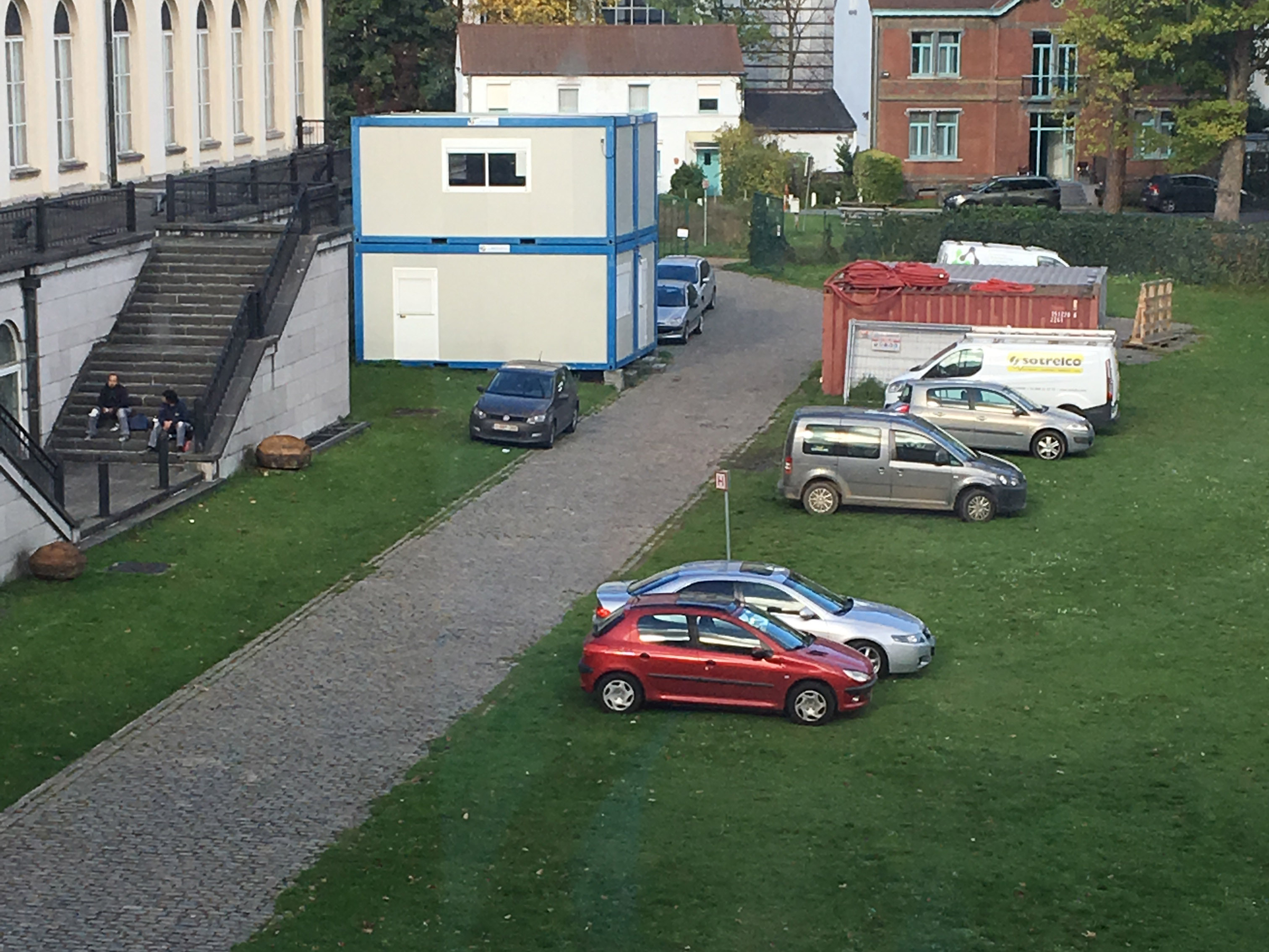 |
| Close up view of the RBINS and position of the three parkings. | view of parking P3. |